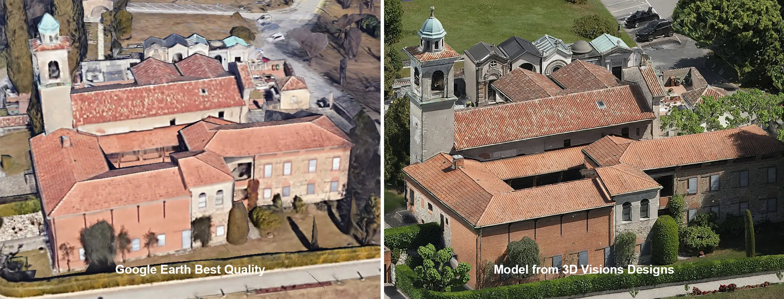
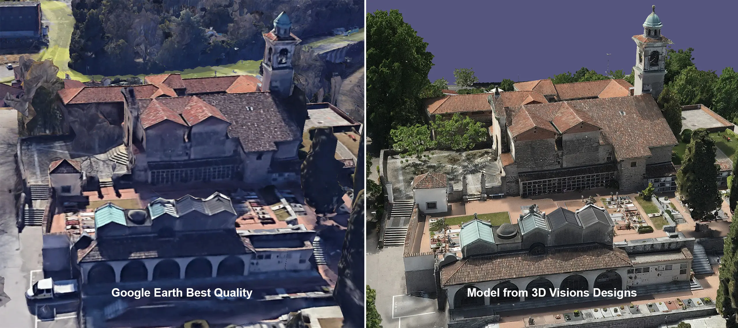
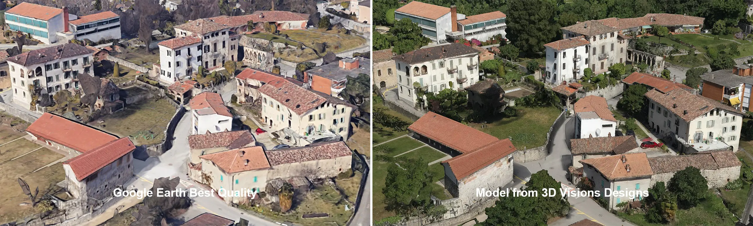
Comprehensive surveys and 3D modeling of high-resolution, accurate, detailed, and documented digital twins of historical monuments.
Digitization, documentation, survey, and inventory of Swiss cultural and architectural heritage.
Precision 3D surveys using terrestrial and aerial drone photogrammetry.
Interior surveys using laser scanning (Lidar).
Interior and exterior 3D modeling.
Generation of high-resolution orthophotos of monument facades and roofs.
High level of detail and faithful texture reproduction.
Centimeter accuracy.
Scan to BIM, 3D modeling from point cloud.
3D models to BIM IFC standards.
Extraction of 2D plans from the 3D BIM model.
Option for hosting and publishing textured 3D models online via a 3D viewer.
Option to add information to 3D models: descriptions, illustrations, external links.
High-resolution immersive virtual reality tours.
Textured 3D meshes, for visualization and measurement purposes.
3D Model & Orthophoto of a listed farm.
Performed using aerial drone and terrestrial photogrammetry.
Centimeter precision.
Hercules.
3D modeling of a statue using terrestrial photogrammetry.
3D viewer user guide.
- Measurement functions for distance, perimeter, surface area, volume, altitude, elevation difference, and slope by clicking on the
 icon.
icon. - Ability to add annotations, images, links, defect descriptions, intervention tracking, views of points of interest, or other remarks by clicking on the
 icon.
icon. - Display of layers, measurements, and annotations
 .
. - Display of photos and cameras, icon
 , and orthophotos, icon
  (if available).
 - Description of keyboard shortcuts and navigation functions by clicking on the “Help” icon.
- Measurement functions for distance, perimeter, surface area, volume, altitude, elevation difference, and slope by clicking on the