Some Examples of Our Work.
Exterior textured meshes, for visualization and measurement purposes.
- 3D Model created using aerial and terrestrial photogrammetry.
- Centimeter accuracy.
3D Viewer User Guide.
- Measurement functions for distance, perimeter, surface area, volume, altitude, elevation difference, and slope by clicking the
 icon.
icon. - Display of photos and cameras
 and the orthophoto
  (if available).
 - Ability to add annotations, images, links, defect descriptions, intervention tracking, views of points of interest, or other remarks by clicking the
 icon.
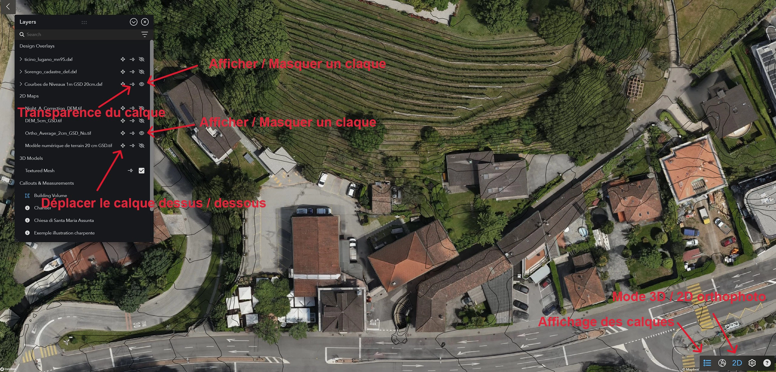
icon. - Display of layers, measurements, and annotations
 .
. - Display of the perspective view: Alt+W (double-click to recenter), return to the orthographic view, click
 .
. - Description of keyboard shortcuts and navigation functions by clicking the “Help” icon.
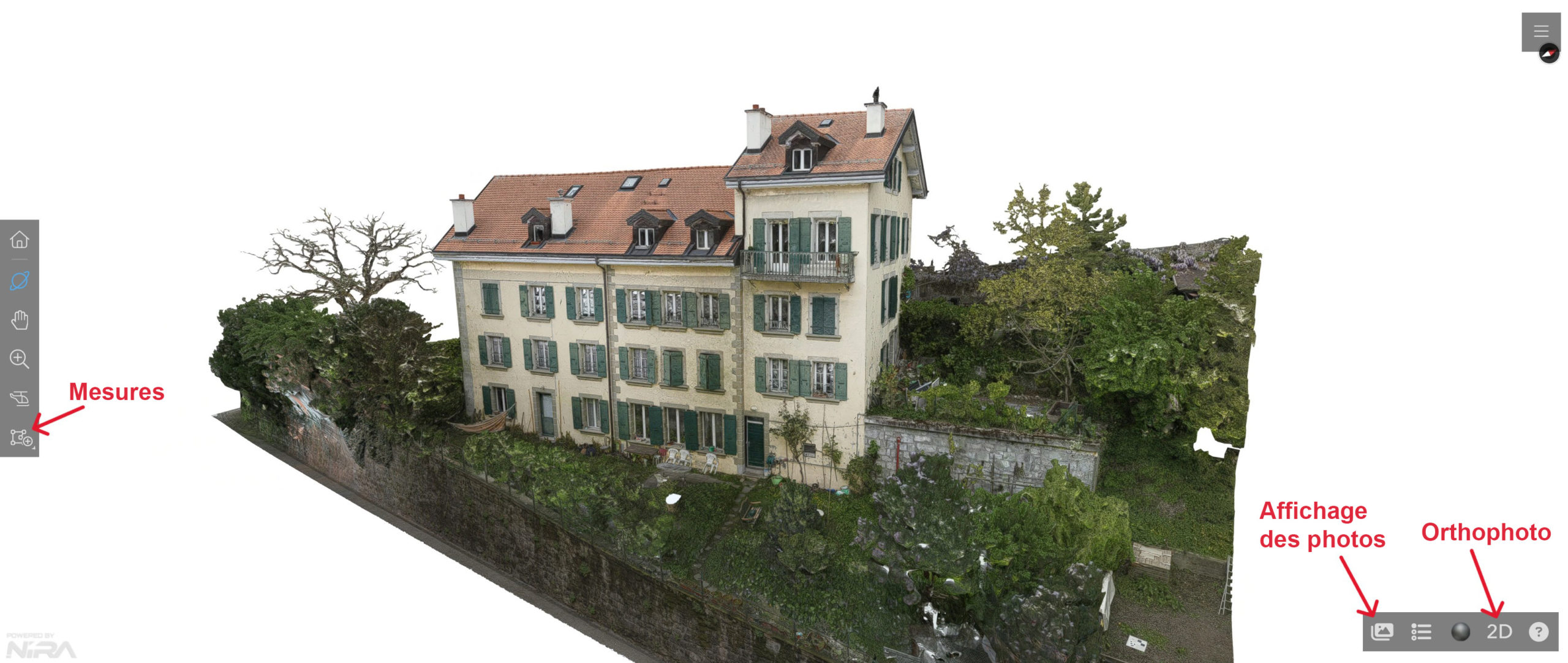
Measurement Modes / Photos / Orthophoto
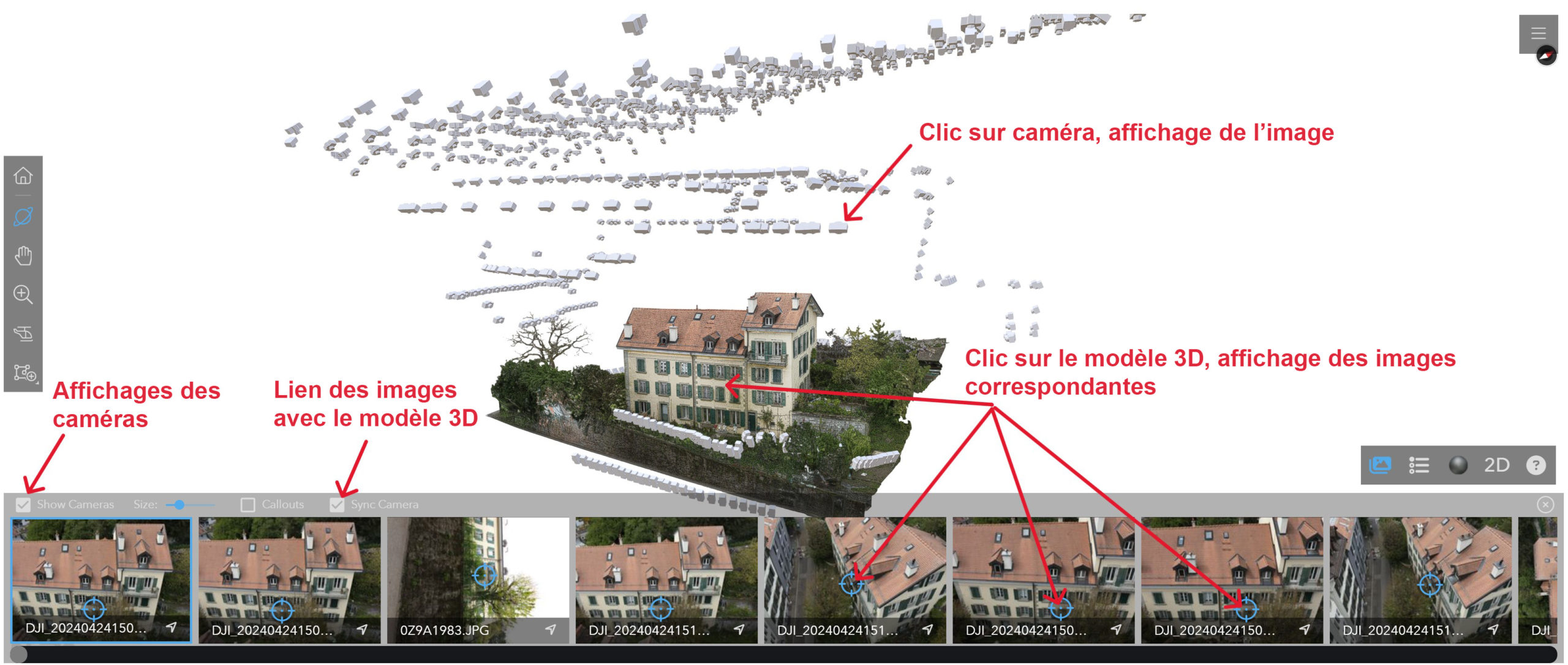
Display of images and cameras
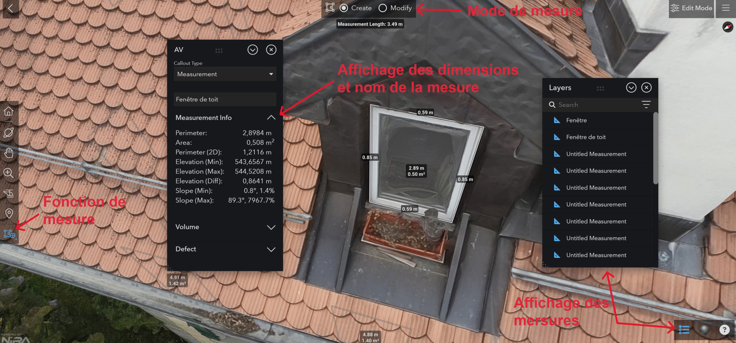
Measurement Functions