Precision 3D topographic surveys by drone and laser scanner (Lidar), mapping, orthophotos, and creation of ultra-detailed 3D digital twins.
Engineering, geomatics, urban planning, and Geographic Information Systems (GIS).
Aerial drone photogrammetry and traditional measurement techniques, theodolite, GNSS RTK.
3D mapping and precision topographic surveys.
Creation of ultra-detailed 3D digital twins at the scale of cities and municipalities.
We are specialized and certified for urban surveys.
Development of large-scale True Orthophotos.
Topographic map, contour lines. Scales from 1:10 to 1:100,000.
Precision measurements, monitoring of walls, rock, bridges, engineering structures.
Large-area monitoring, mountains, rock faces, dams, glaciers.
Layout of buildings and roads.
Digital Terrain Models DTM and Digital Surface Models DSM, profiles, sections.
Volumetric calculations, excavation, earth moved, material deposits.
Public lighting cadastre, night photogrammetric survey, night orthophoto, analysis and simulations.
High-resolution road and highway surveys (0.5 cm/pixel), absolute precision 1.5 cm.
Thermographic measurements and analyses. Building insulation, monitoring of solar installations.
Geographic Information Systems (GIS), open-source QGIS specialist.
Management, hosting, and dissemination of large data volumes.
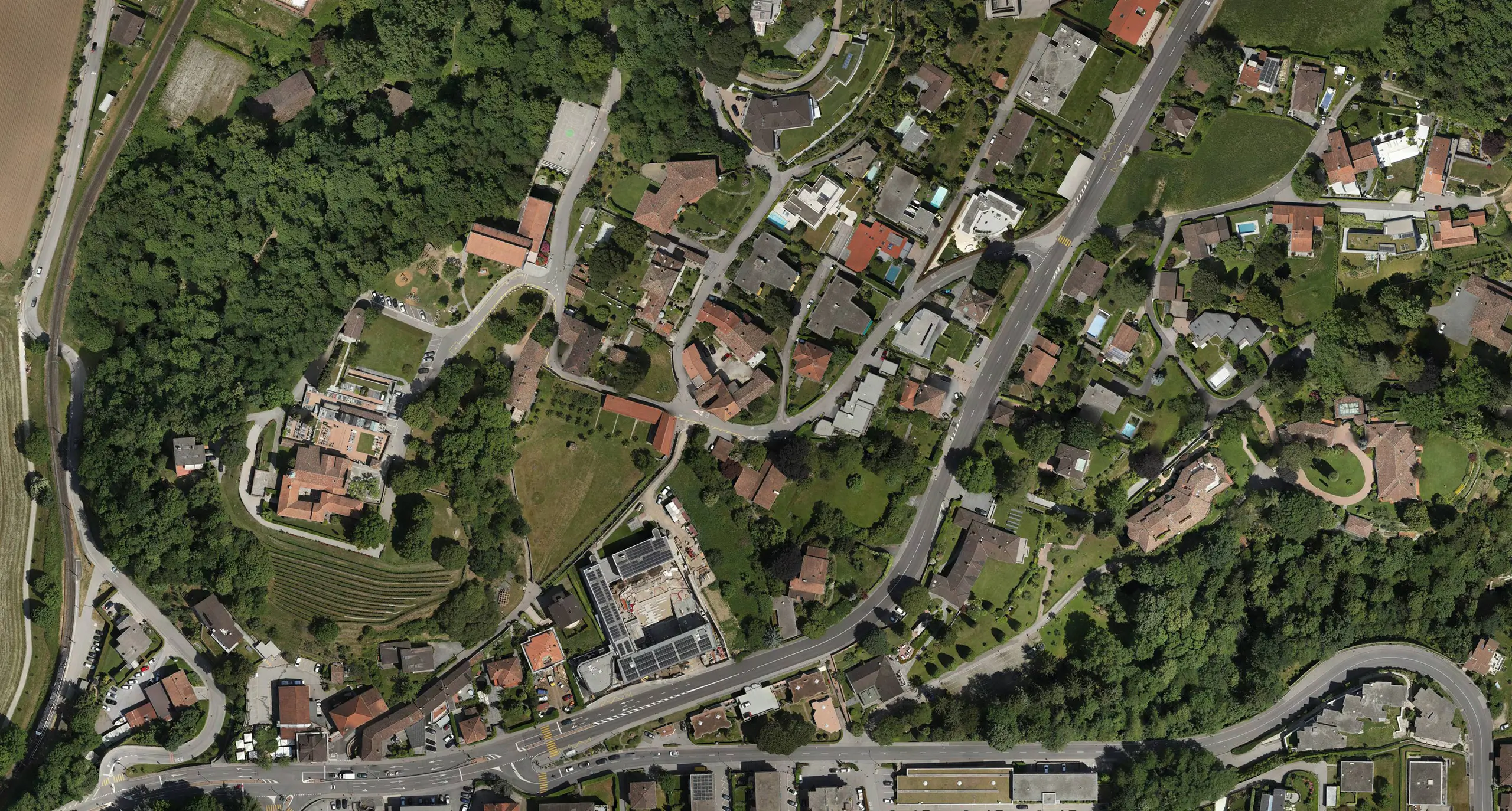
True Orthophoto
3D Modeling by Aerial Photogrammetry Resolution 2cm/pixel
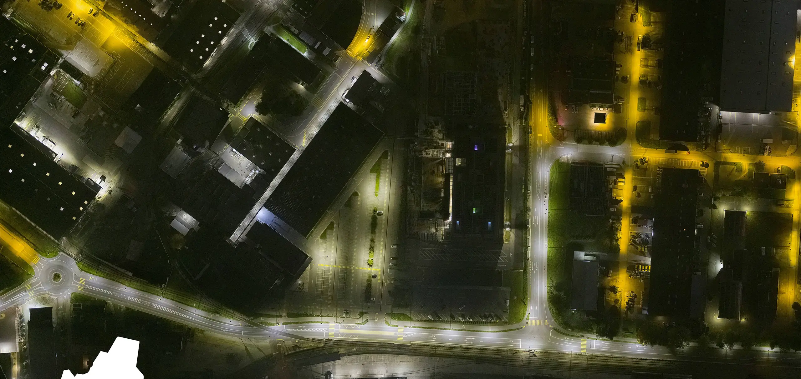
Night Orthophoto
Public Lighting Cadastre
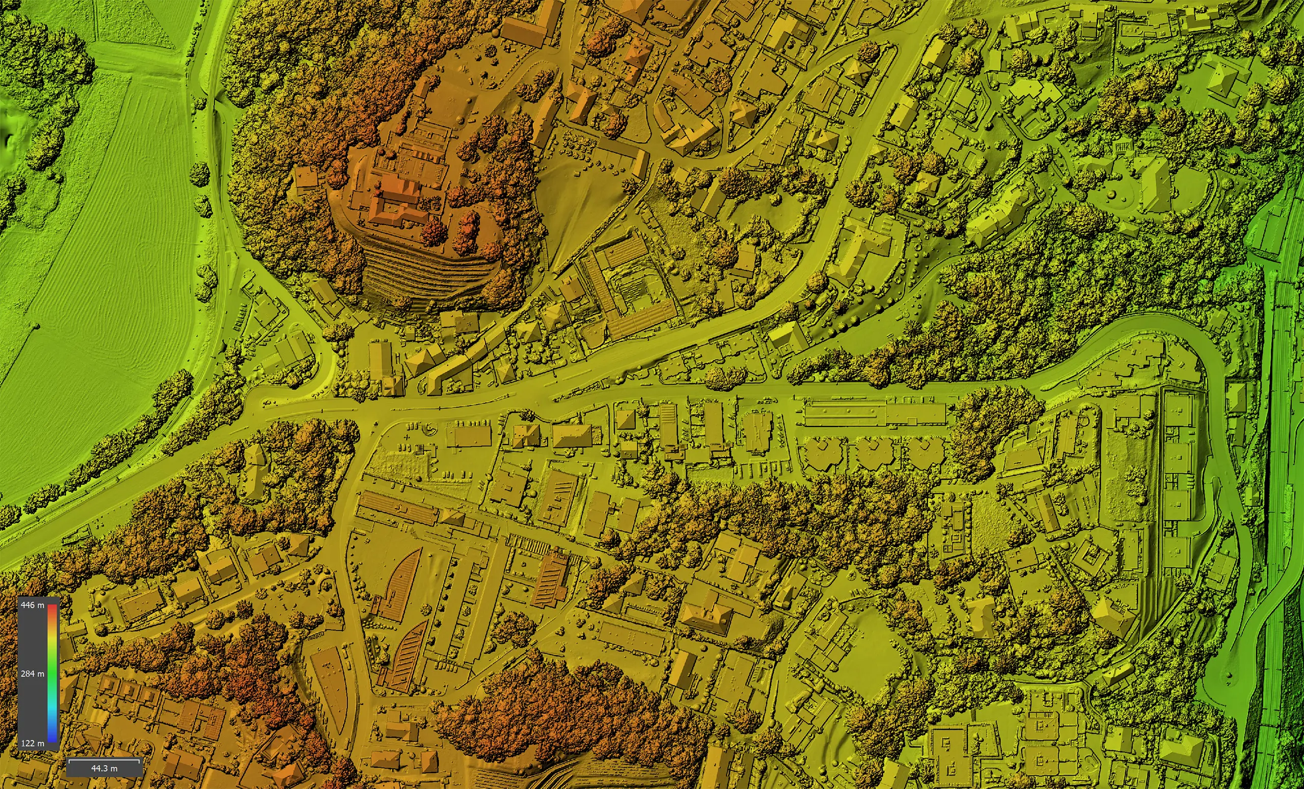
Digital Surface Model
3D Modeling by Aerial Photogrammetry Resolution 2cm/pixel
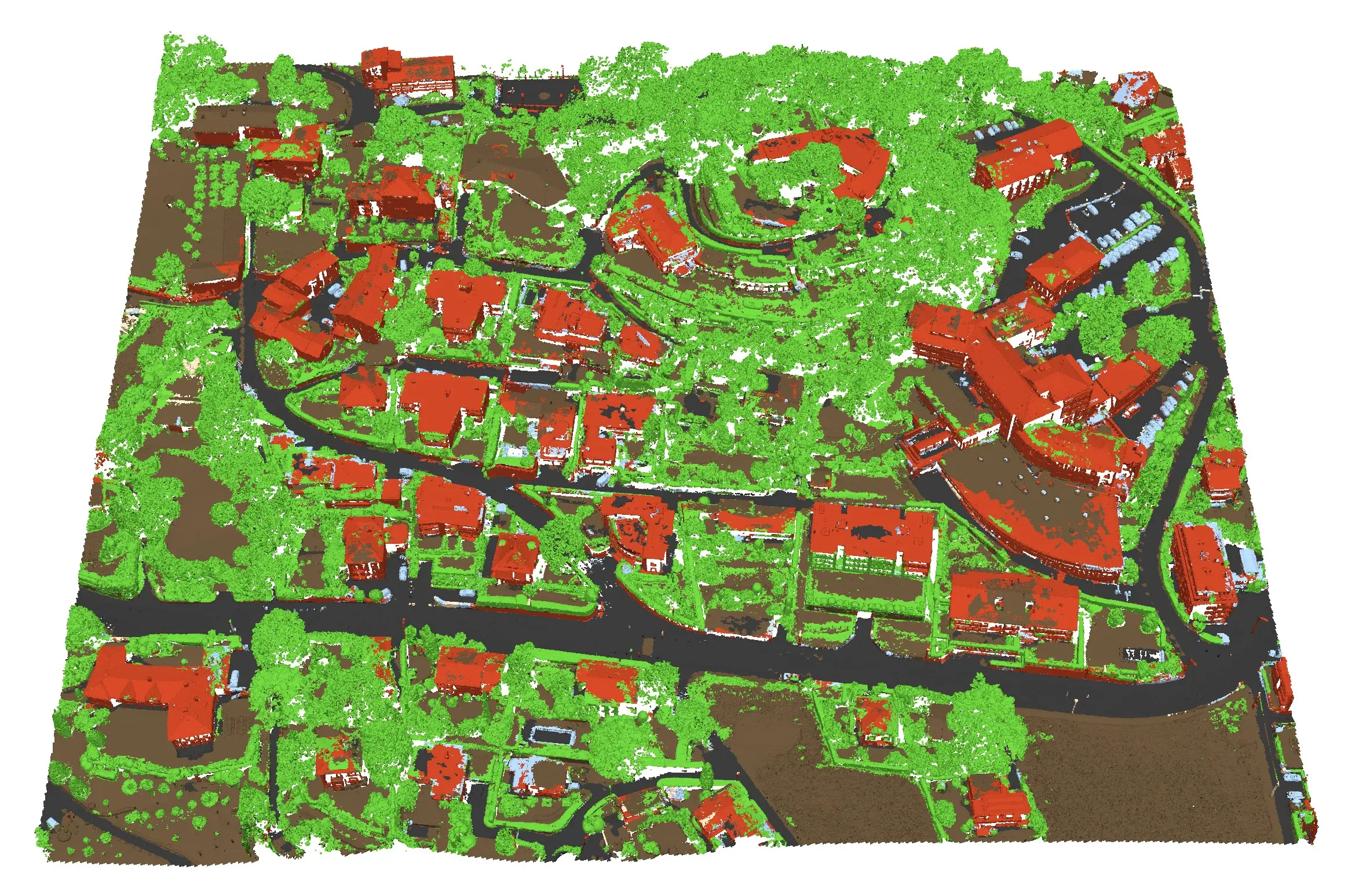
Classified Point Cloud
Vegetation, Buildings, Roads, Terrain, Vehicles
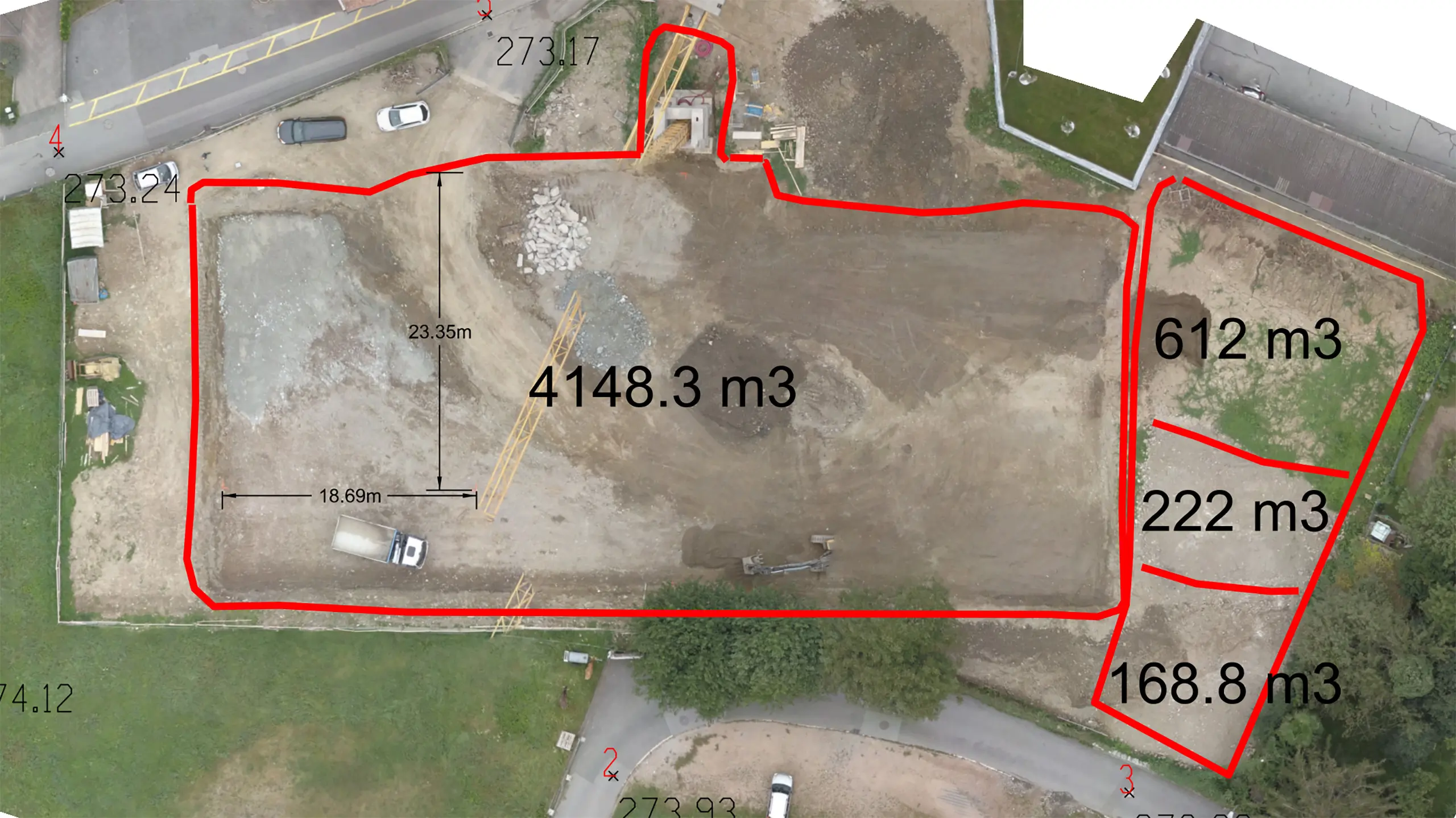
Cubatures & Volumetrics
Calculation of excavation volumes
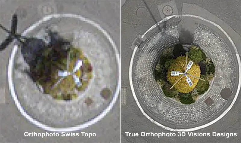
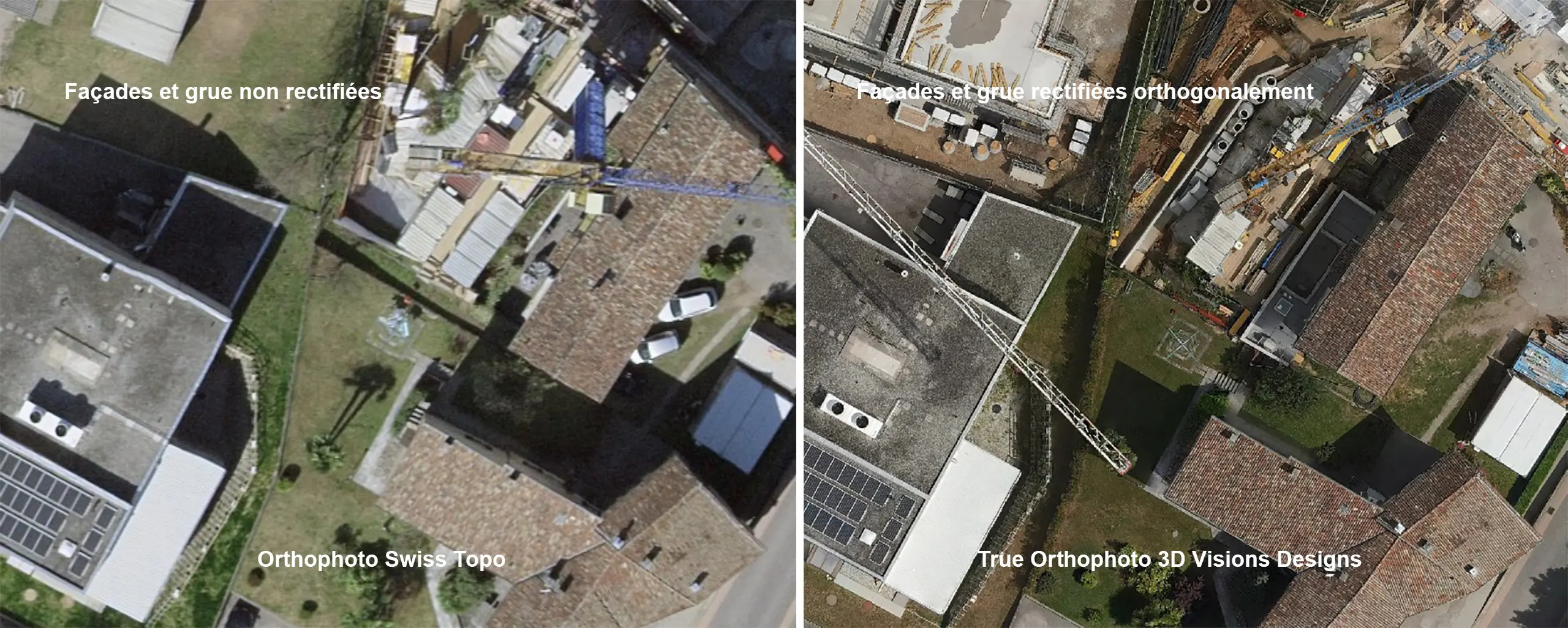
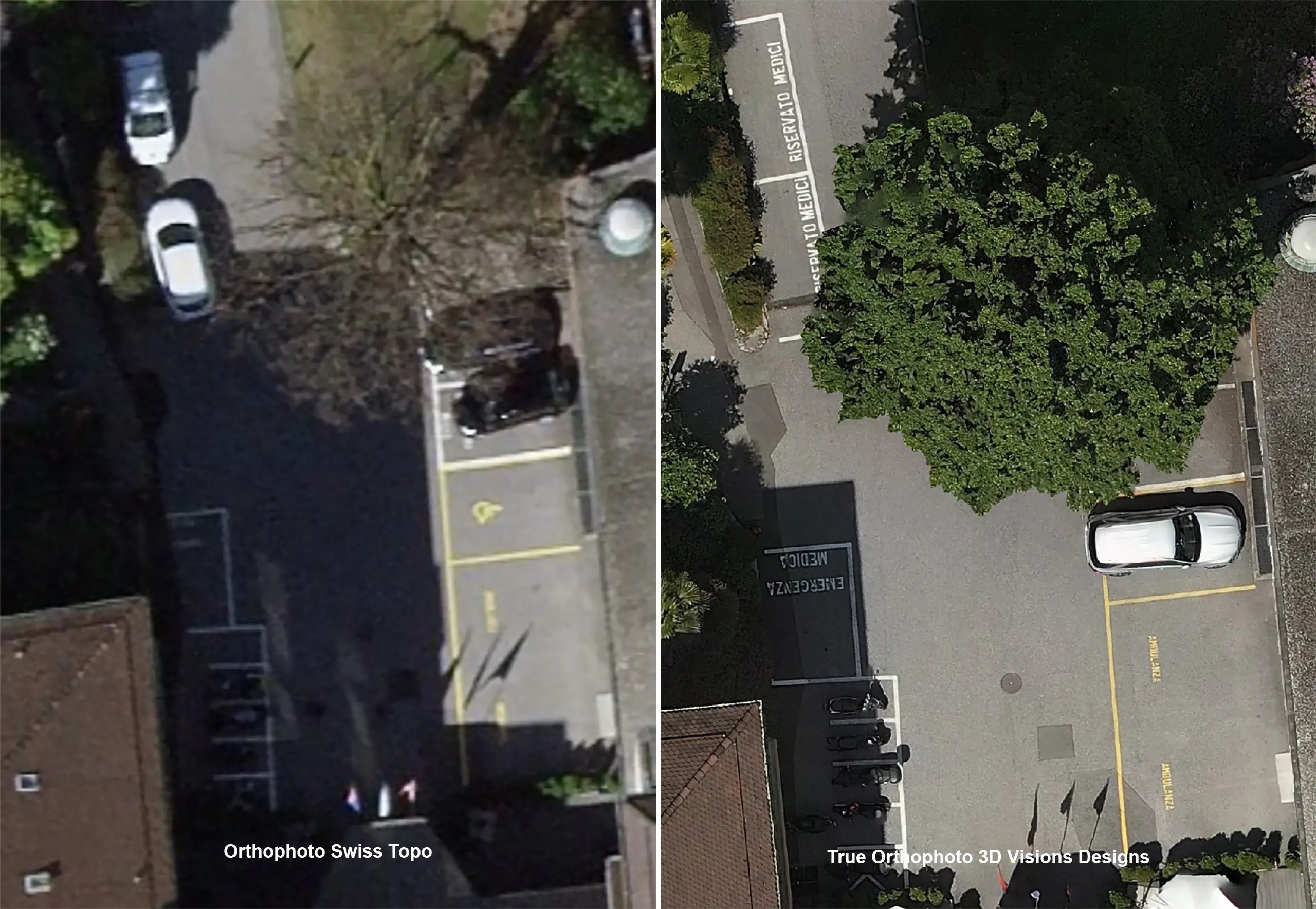
Orthophoto VS True Orthophoto
Resolution, precision, and corrected orthogonality
Orthophoto VS True Orthophoto
True Orthophoto, corrected orthogonality
Orthophoto VS True Orthophoto
Resolution and precision
3D model, orthophotos, and digital terrain model of a municipality.
3D viewer user guide.
- Functions for measuring distance, perimeter, surface area, volume, altitude, elevation difference, and slope by clicking on the
 icon.
icon. - Ability to add annotations, images, links, defect descriptions, intervention tracking, views of points of interest, or other remarks by clicking on the
 icon.
icon. - Display of layers, measurements, and annotations
 .
. - Display of orthophotos and the digital elevation model, icon
 .
. - Description of keyboard shortcuts and navigation functions by clicking on the “Help” icon.