As-built surveys, 3D modeling, Scan to BIM, and 2D plan vectorization for architecture.
Services dedicated to architecture, real estate management companies, general construction companies, and facility management.
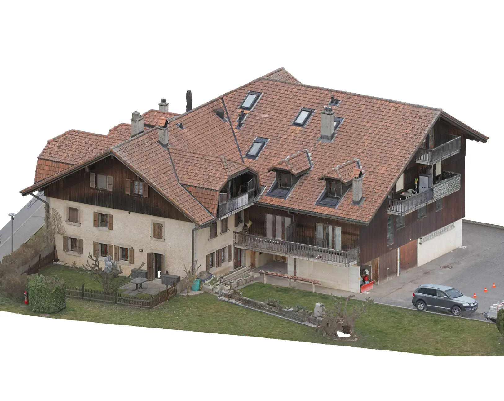
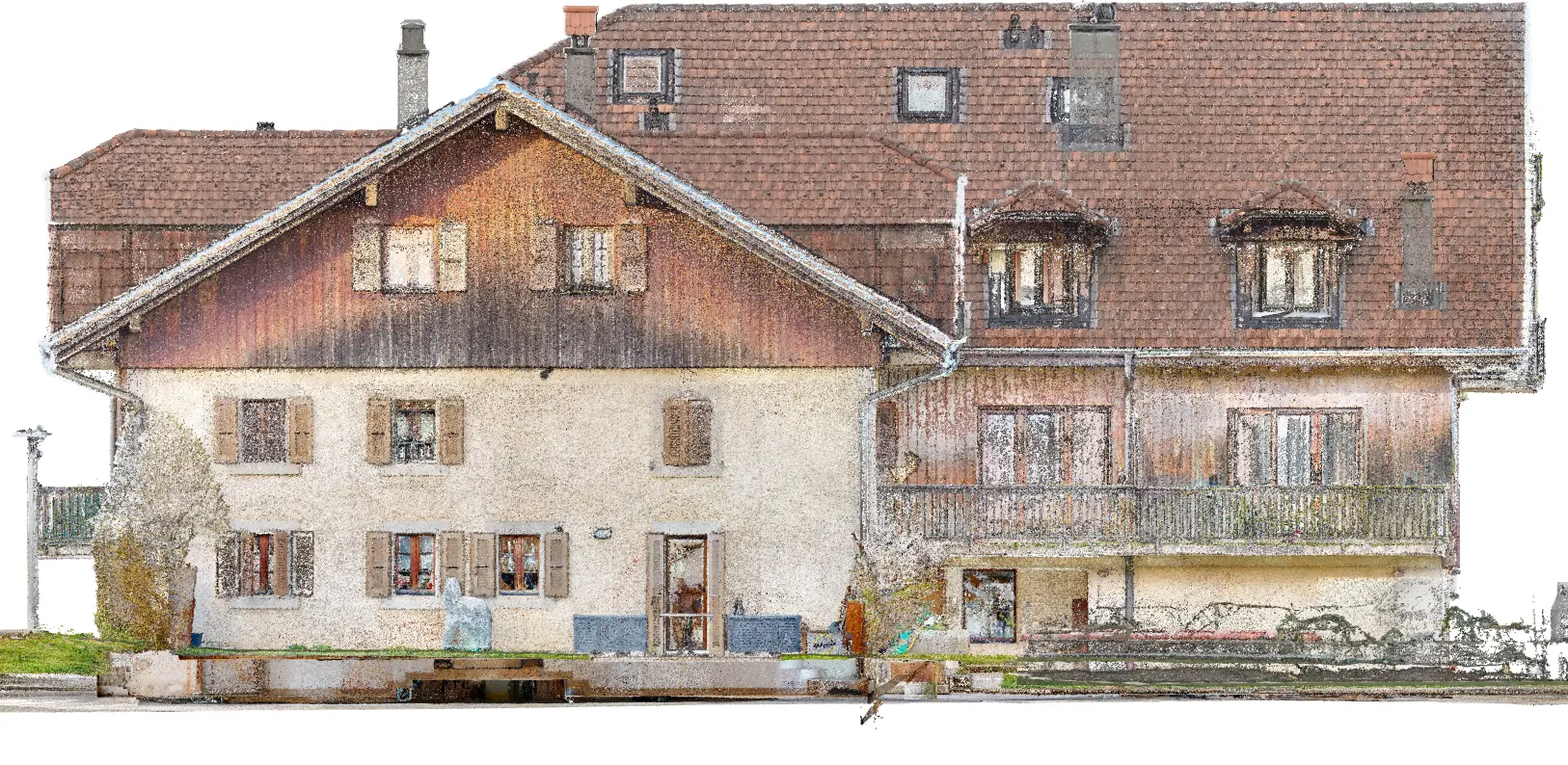
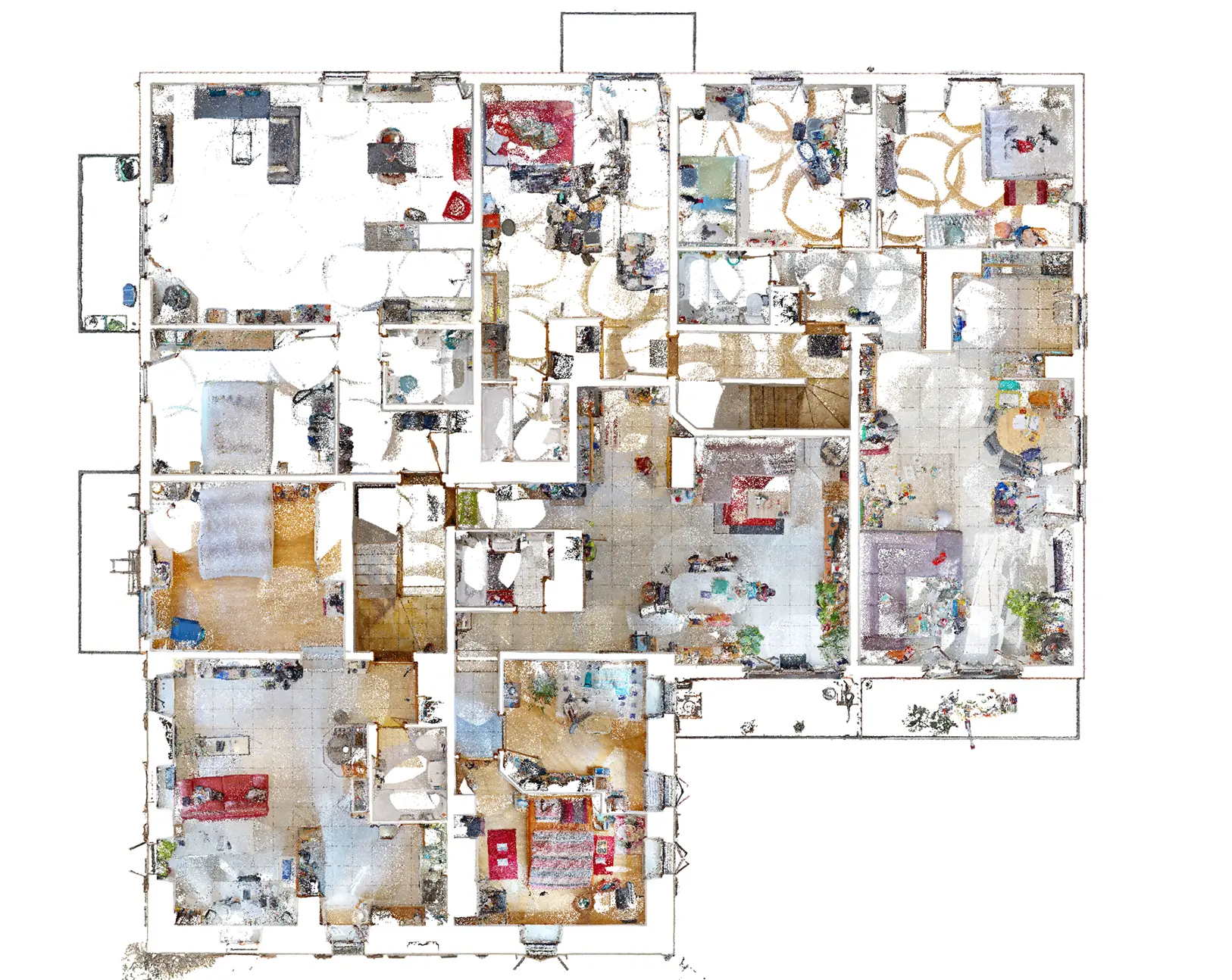
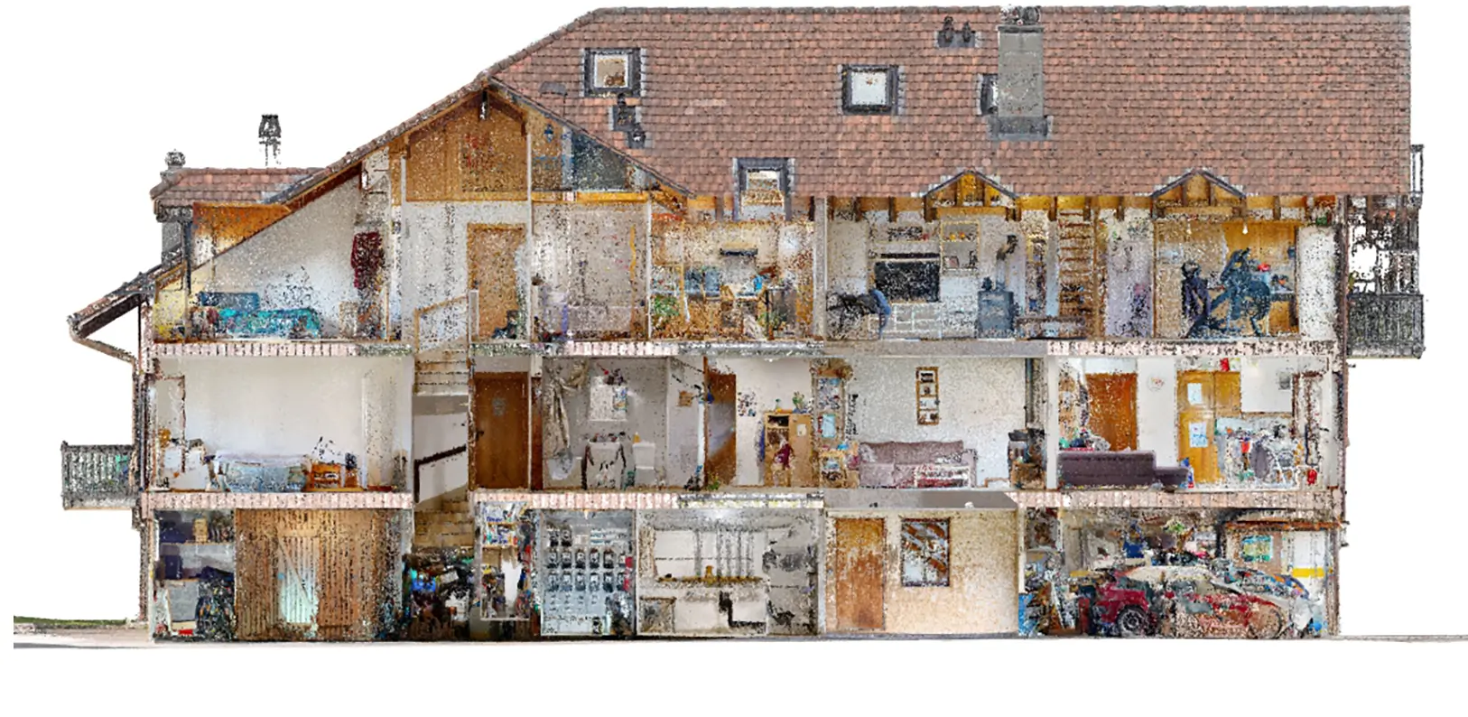
Indoor & outdoor 3D surveys by aerial drone photogrammetry and laser scanner (Lidar).
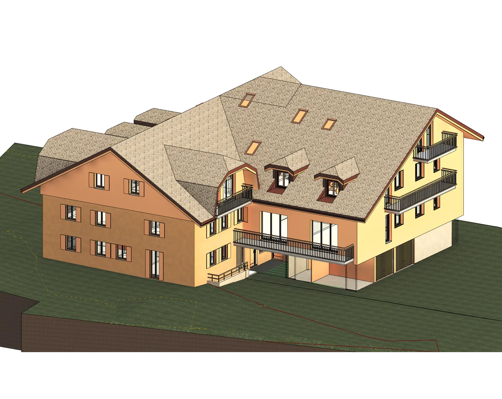
Scan to BIM, 3D modeling from point cloud data.
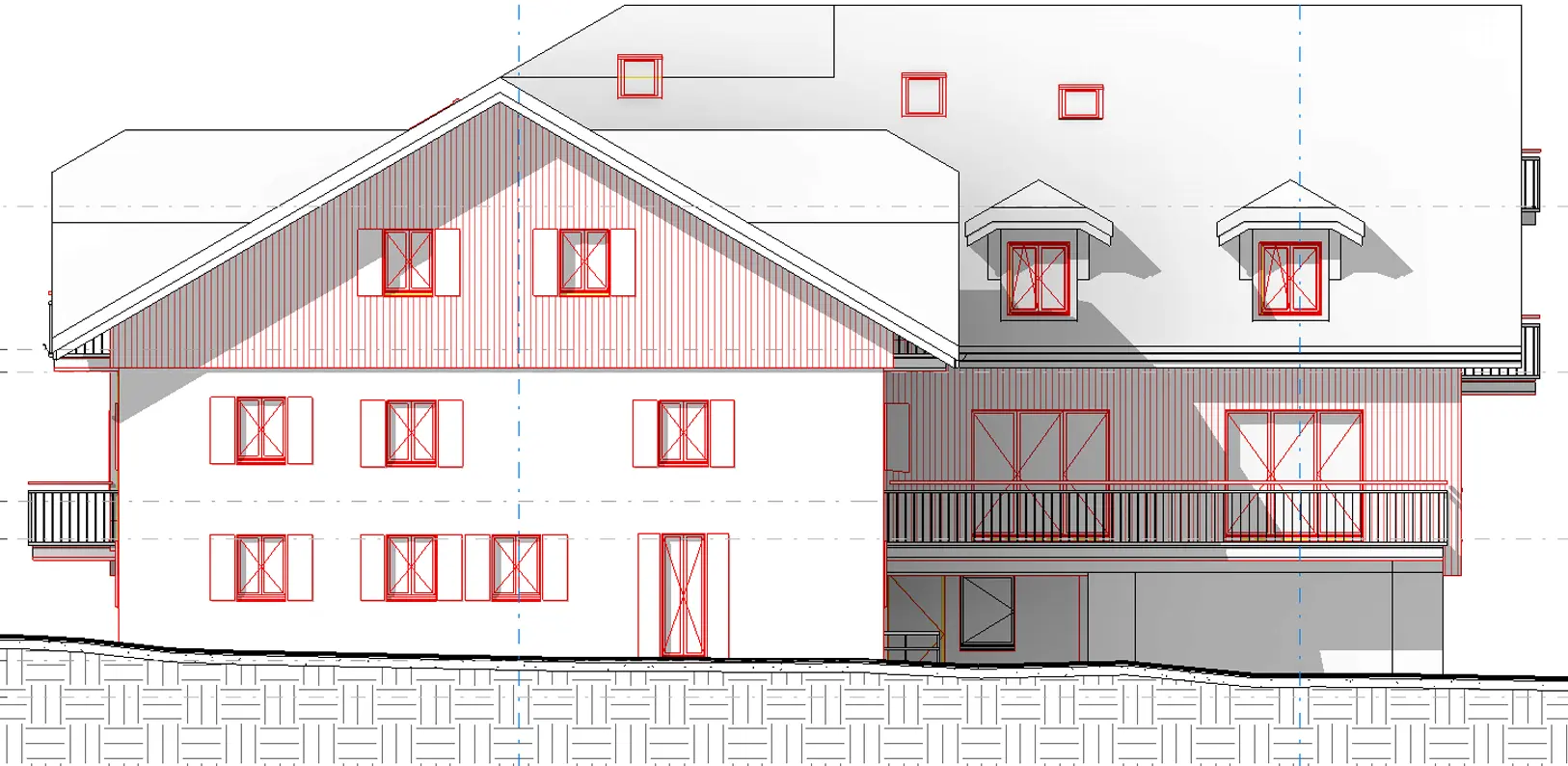
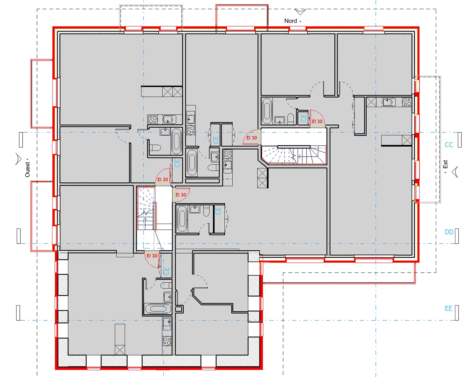
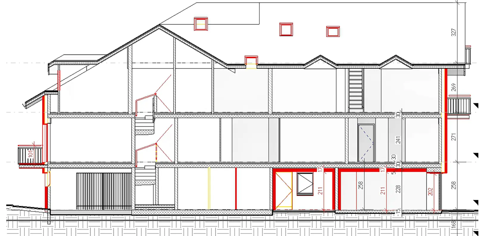
Vectorization of 2D floor plans, elevations, and section plans from point cloud data.
Survey plans at 1:100 scale and execution plans at 1:50 scale or others upon request.
BIM IFC compliant 3D models.
Plans compliant with SIA standards.
Centimeter precision.
Generation of orthophotos for plots, roofs, and building facades.
3D modeling and terrain georeferencing.
Generation of contour lines at all scales and resolutions, with centimeter precision.
Integration of synthetic architectural models into existing environment 3D models.
Thermographic measurements and analyses. Building insulation, solar installation monitoring.
Scan to BIM, 3D modeling
Facade Elevation 1:100
Floor Plan at 1:100
Cross Section 1:100
BIM IFC Digital Model
3D viewer user guide.
- Functions for measuring distance, perimeter, surface area, volume, altitude, elevation difference, and slope by clicking on the
 icon.
icon. - Ability to add annotations, images, links, defect descriptions, intervention tracking, views of points of interest, or other remarks by clicking on the
 icon.
icon. - Display of layers, measurements, and annotations
 .
. - Display of photos and cameras, icon
 and orthophotos, icon
  (if available).
 - Description of keyboard shortcuts and navigation functions by clicking on the “Help” icon.
Abracadabra, 3D, Visions, Vision, Design, Vincent, Depeursinge, Measurement, Precision, Monitoring, Layout, Plan, Topographic, Photogrammetry, Photogrammetric, Aerial, Laser Scan, Lidar, True, Orthophoto, Model, Digital, Terrain, Architecture, Engineering, Civil, Monument, Historic, Real Estate Promotion, Cultural Heritage, Surveyor, Geomatics, GIS, BIM, Printing, Model, Model Making, Urban Planning, Drone, Patent, Survey, Switzerland, French-speaking Switzerland, German-speaking Switzerland, Ticino, Europe, DJI, M300, Mavic 2 Pro, Phantom 4 Pro V2.0, RTK, GNSS, Trimble, Leica, BLK 360, Mesh, Video Editing, 4k, Cadastre, Economy, Energy, Plan Vectorization, Facade