Precision Aerial Drone Photogrammetry and 3D Modeling, Laser Scanner Surveys, Scan to BIM, and Creation of Ultra-Detailed Digital Twins.
Architecture, Civil Engineering, Urban Planning, Historical Monuments, Real Estate and Tourism Development.
SORA Operational Authorization according to OFAC and EASA Requirements.
Remote Pilot Certification Specific EASA STS1 STS2 Categories.
Use of a professional DJI M300 RTK drone offering a high level of precision and safety.
Mapping and Creation of Ultra-Detailed 3D Digital Twins at the Scale of Cities and Municipalities.
Development of High-Resolution and Large-Scale True Orthophotos.
We are active in Romandy, German-speaking Switzerland, Ticino, and Europe.

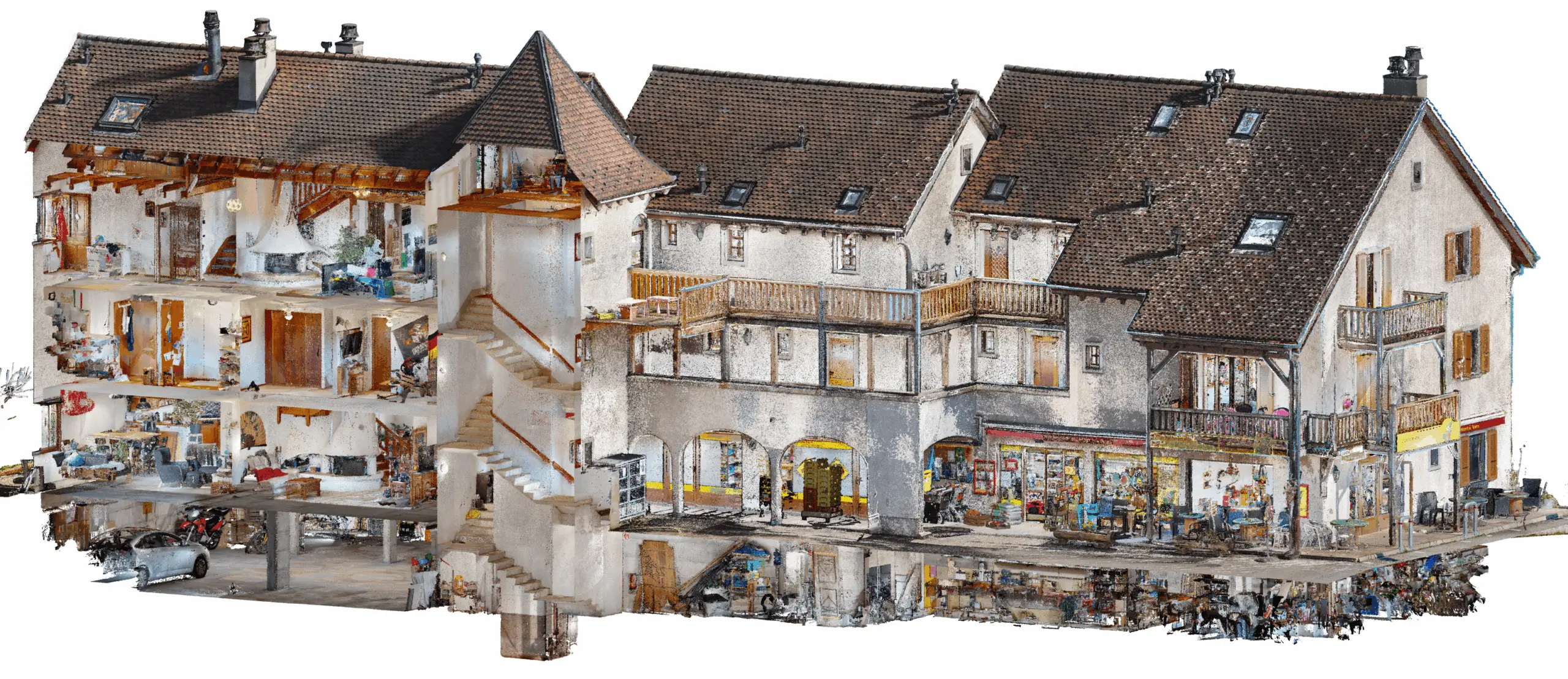
Indoor and Outdoor 3D Surveys of Buildings and Monuments.
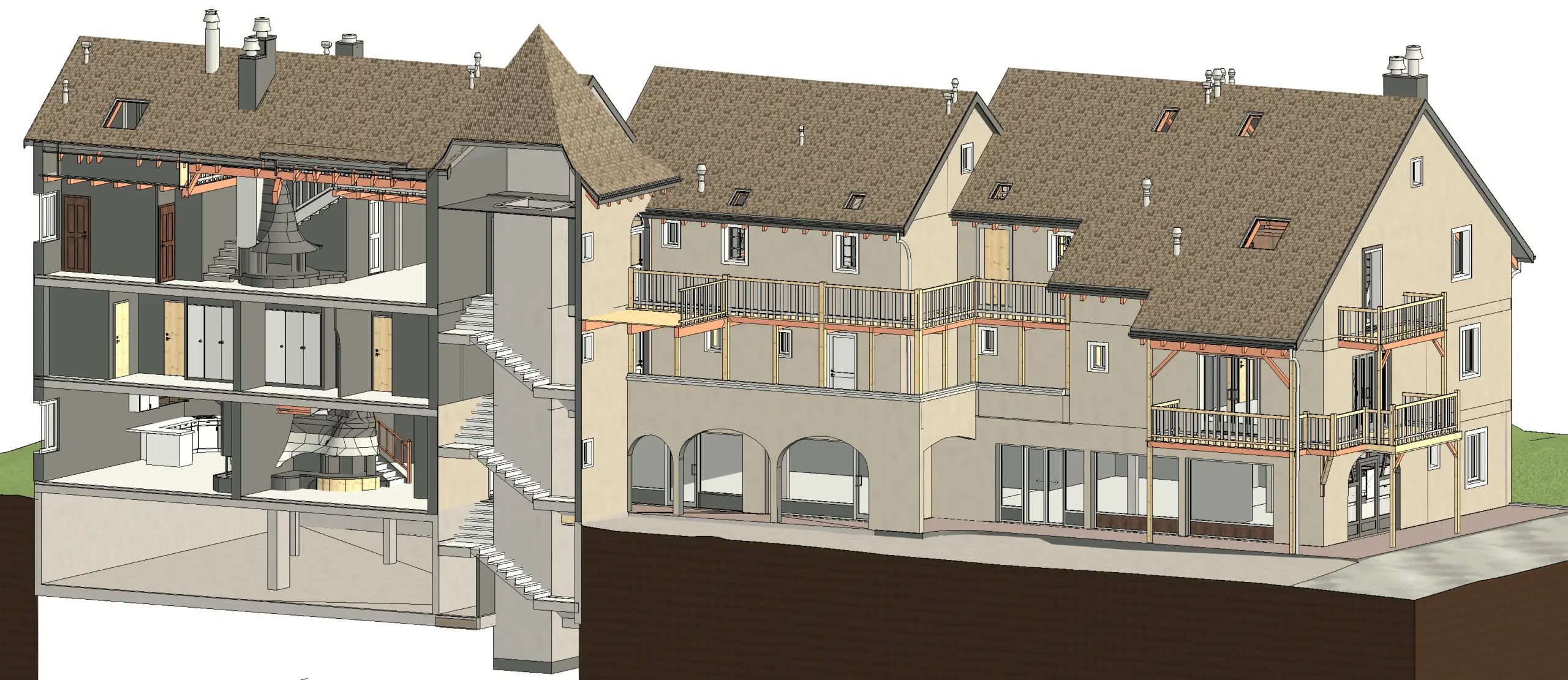
Scan to BIM, 3D BIM Modeling from Point Cloud Data.
Development of Architectural Plans, Floor Plans, Elevations, Section Plans, and Site Plans.
Development of Models for Urban Planning, Architecture, Engineering Structures & Monuments.
3D Resin Printing in 10 Million Colors